Resource Mapping
The Tool
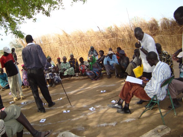
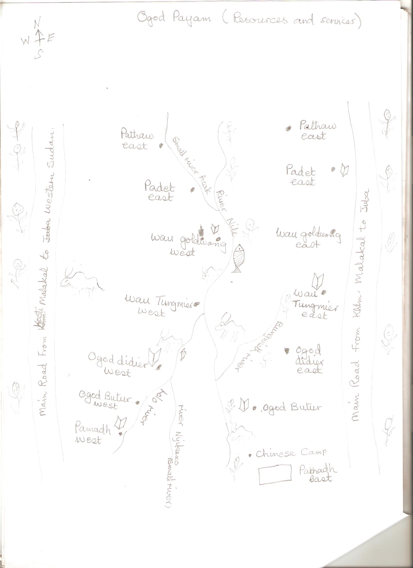
Resource mapping, otherwise referred to as Village Resource Map is a model (on the ground or on paper) of the area (village) as perceived by the community members. This visualization is done by a mixed group of villagers including the elderly and the young community members. The area in question must be specific in order to create a focal point for the ensuing discussions. For example, a SRM of a village or two neighbouring villages can be used.
This is one of the most PRA basic tools. It gives the community and outsiders a chance to appreciate, at a glance, the geographical aspects of the village, the resource base at the village and the spatial distribution of the resources. It creates a certain understanding within the community of what their spatial situation is and gives them an opportunity to discuss what could be done to improve any undesirable aspects. The information / discussion arising out of the tool can probably include:-
- the village area boundaries as perceived by the community
- the resources available at specific points within the village
- the opportunities/options available within specific geographic points in the village
- problems that are specific to certain areas in the village
- resources available outside the village but which are used by the community members
- what can be done to exploit existing opportunities or address existing problems from the community's point of view
How to implement
A natural starting point for developing the village resource map could be a question by the PRA facilitator on how far the village extends. Other guiding questions could be:
- how big is this village?
- which is the furthest houseshow far does the village extend from here to the end walking?
- could we make a rough sketch on the ground/paper to understand the extend.
- Can we put them on the map?
- where are the roads in the village?
- are there grazing land, farmland, forests?
- Are there hospital, clinics, dispensaries, schools?
Each of the items topics mentioned is placed physically on the map using a symbol e.g. a stone for a school, leaves for farmland, sand for rivers and so on. The facilitator or a literate community member writes down all the discussions on a notebook for discussion later.
The output
As the map is being model a member of the community should be putting down all the discussions taking place including points of conflict in the discussion. At the end of the exercise, the resource map provides a most comprehensive database about the village from the villagers themselves. In addition it identifies areas of interest or options for development from the community. The map also provides the basic information required to undertake two other tools – the village vision and the mobility map.

|
Copy ofResources and services.jpg Size : 180.179 Kb Type : jpg |